Accession card
Description
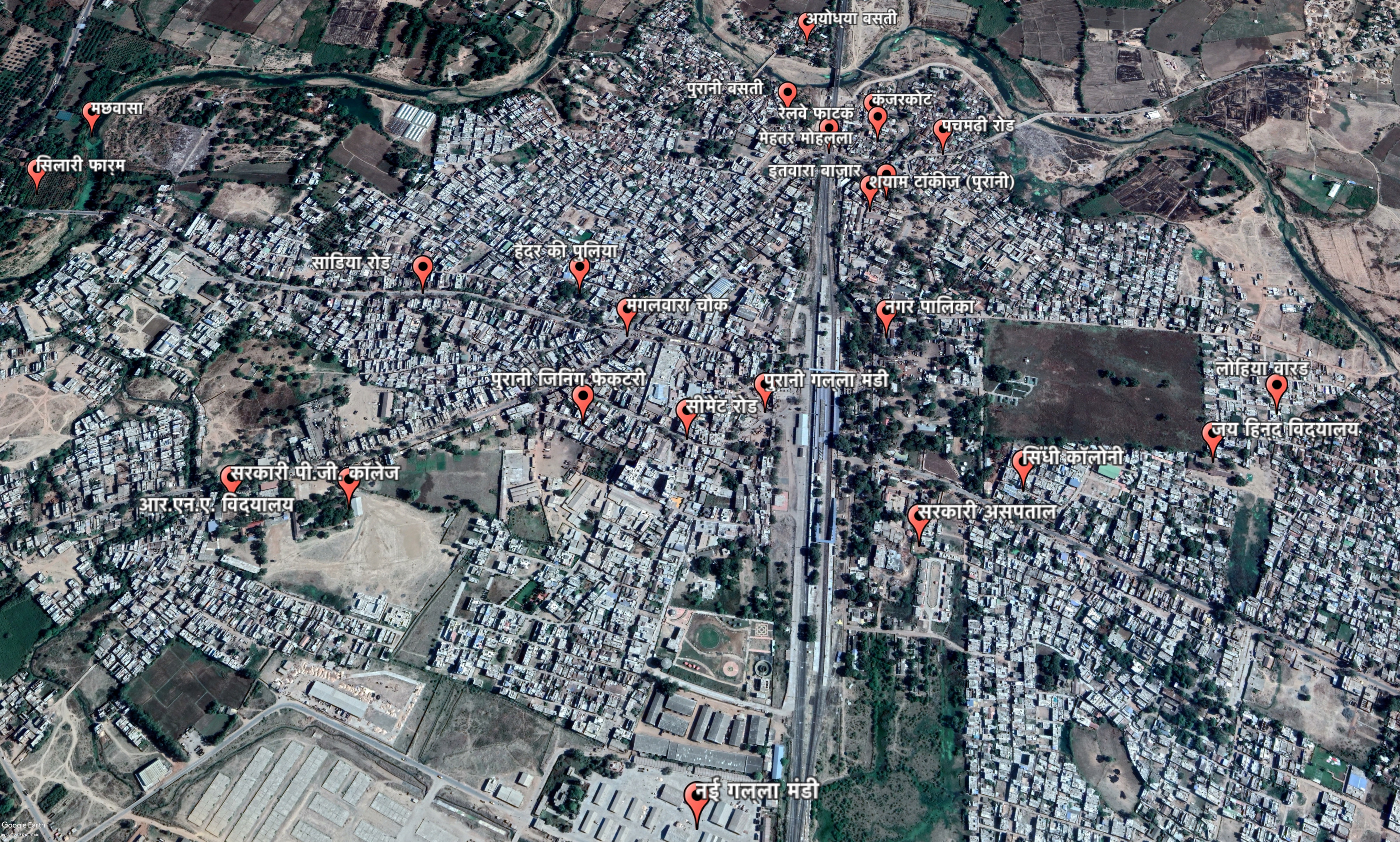
A Google map representation of the town of Pipariya situated in Madhya Pradesh, India. The map is marked with 25 local neighbourhoods (names in Hindi script Devnagri) that were an often-recurring reference point in the oral narratives recorded with the residents of the town. Highlighting the politics of everyday spaces, the map can be considered a visual marker of a settlement where some places are more or less relevant than others.
Project
Code
HAB-1-308549581
Date
2019
Credits / copyrights
Image Copyrights: This map is a part of an upcoming publication on the settlement histories of the town of Pipariya.
University
Centre for Community Knowledge, Ambedkar University Delhi
Title
Mapping the Neighbourhoods
Medium
- Image


